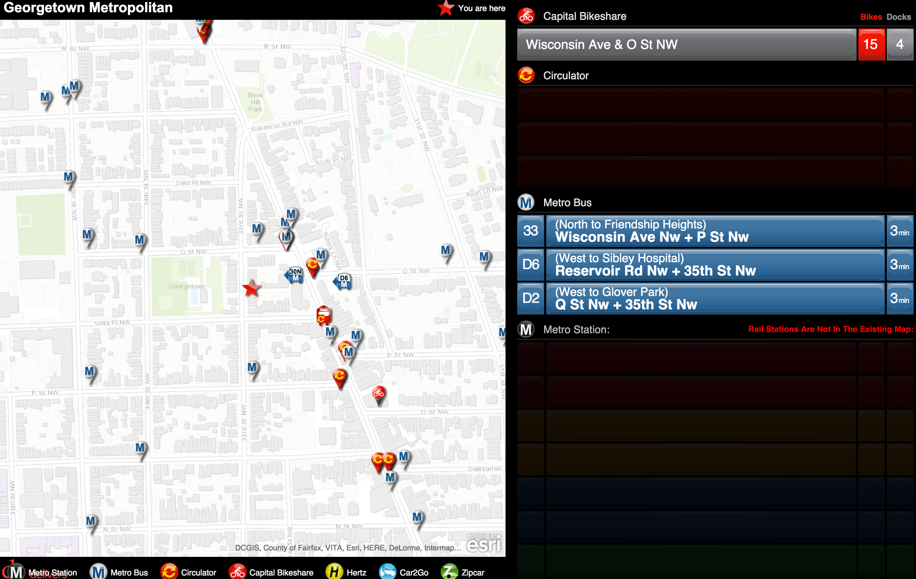
Yesterday DDOT released a very cool new program on its website: a personalized transit screen. Transit screens, which have appeared at some bars and other businesses around town, are flatscreen tv’s that display real-time data on all the various transit options that are within a certain distance of the establishment.
Now DDOT is letting you design your own by creating a profile and plugging in whatever address you want. For instance, the screenshot above is from a transit screen GM created for the Georgetown Metropolitan, whose offices happen to be GM’s couch.
It shows the Nextbus arrivals for the close-by buses, the availability of bikes at a bikeshare dock, and any Car2Gos or ZipCars around.
It’s a handy way to see all the options at once. And seeing all the options at once has the side benefit of informing people just how many options there are. Small businesses and bars might want to set up a small computer screen and create their own map. Check it out!


you might like to have this app available at the hotel. it is really neat.