Vision Zero is a popular government initiative under which cities or countries pledge to eliminate all roadway fatalities. More than just lofty goal-setting, a successful Vision Zero initiative identifies what conditions lead to fatalities and eliminates those conditions.
Mayor Bowser has signed on in concept with Vision Zero, setting 2024 as the deadline to achieve zero fatalities. Some have questioned the city’s dedication to make the tough decisions to achieve zero deaths regardless of the inconvenience to drivers. But it’s still early, and GM is willing to give it a chance.
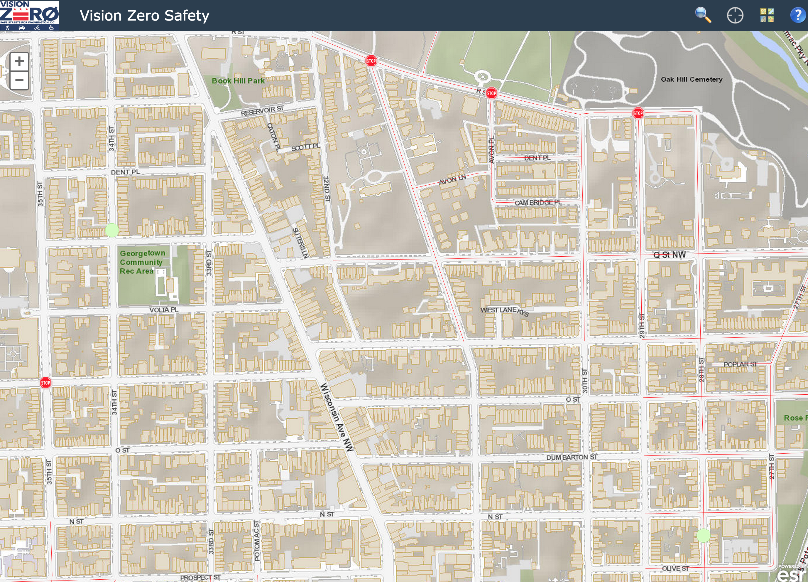
One of the pieces of the city’s initiative is a crowd sourcing map that allows anyone to identify a location of potential danger. Click on a location anywhere on the map and you’re asked to identify the nature of the danger (e.g. speeding, cars running stop signs, jaywalking, etc.) and then provide additional comments.
It also asks for you to identify what type of user you are (i.e. driver, pedestrian or bicyclist). It’s sort of an odd request because you can be all three. But it’s probably just a way to identify who is identifying the danger.
You can also view and comment on other people’s submissions. For Georgetown there are a handful so far, mostly about cars running stop signs.
Will the city actually use this data to identify and address problems? Who knows. But as long as they’re asking we might as well let them know where the problem spots are.


The danger of head on collisions on North Capitol with ambulances and fire trucks, forced by existing traffic backups, to hop the median is a constant threat to life and limb. If you are coming south and a huge fire truck hops the median and is on coming toward your vehicle, you will HOPE to be a fatality. This would be one serious collision best not to survive. The area around McMillan Park, N. Capitol and Michigan Ave, is a FAILED traffic bottle neck, and the Transportation Impact Study by developer Vision McMillan Partners is faulty and doesn’t even mention emergency vehicles, Emergency Evacuation Route on N. Capitol, or the seven hospitals that serve the immediate area.
What is the game being played on the people of DC by our own elected officials, making the whole city an Urban Heat Island, choked and stifled by unacceptable, dangerous traffic congestion. A corrupt government fixing the process, to serve the developers at our expense, and make DC
ungracious, paved over, carbon emitting, unhealthy and polluted place without parks. SAVE MCMILLAN PARK!