Over the past year I have been trying to pass along the dramatic changes that WMATA is planning for the Metrobus network. Literally every bus line will be different in name and (mostly) route by the end of this year. I recently learned that some tweaks have been made to the plans I’ve circulated, so I wanted to pass those along to you as well.
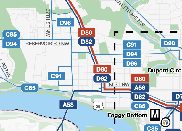
For the benefit of those who have not been following these changes, I’ll try to sum them up here. A good place to start is from the map above, which shows how the various bus routes will pass through Georgetown. It’s probably best to group them in a couple baskets:
Wisconsin Ave.
Since the days of the streetcars, Wisconsin Ave. and M St. have been serviced by the 30 Series. What particular routes ran has changed a lot over the years, but right now we have two routes remaining: the 31 (which goes only to Foggy Bottom) and the 33 (which now goes to Union Station as a substitute for the defunct Circulator). The Better Bus network will maintain similar service, but the names will change. Now it will be the D80 and the D82.
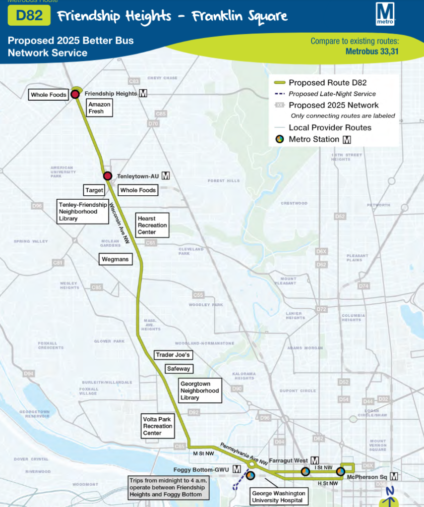
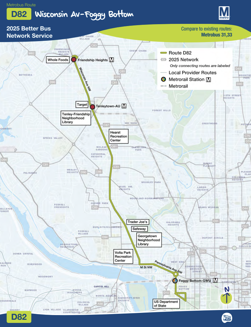
The last time I discussed the possible changes, the only route I discussed was the D82 (if WMATA had proposed the D80 at that point, I must have missed it). This was that previous D82 route:
The D82 Route now only goes to Foggy Bottom, and is basically the same as the current 31:
The D80, on the other hand, would now travel all the way to Union Station, much like the 33 does now:

So in short: the 31 becomes the D82 and the 33 becomes the D80. Travelers along the Wisconsin Ave.-> M St. routes will likely just have to memorize new bus route names. The service will otherwise be fairly similar (although I am working with my ANC colleagues and the BID to make sure that WMATA keeps the frequency to what we’re used to).
East-West Lines
The second basket of routes I think it’s helpful to consider are the primarily east-west routes through the heart of Georgetown. This currently includes the D2, D6 and the G2. The D2 and the D6 cross Georgetown mostly on Q St., with the D6 traveling from Sibley to the west and RFK stadium to the east, and the D2 running between Glover Park and Dupont. The G2 starts next to Georgetown University and snakes through Georgetown on a couple different streets before heading east to Dupont along P St.
Each of these routes will be mostly replicated in the new system, however they will all travel primarily on Q St. as they travel east-west.
Here is the D94, which is the D6 replacement:

As you can see, it will no longer travel all the way to RFK Stadium. This is unchanged from earlier proposals.
Here is the D96, which is the D2 replacement:

This obviously doesn’t look terribly like the current D2 route, but between Glover Park and Dupont, it is basically the same. But now it will continue westward all the way to Bethesda (and on weekdays it will travel beyond Dupont to Foggy Bottom).
This is basically the same as earlier proposal but for one tweak. The route around Dupont appears to be more like the current D2 route than in the prior iteration:
Here is the previous proposal:

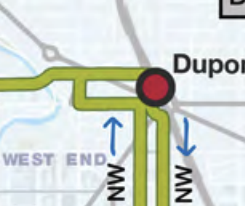
It’s hard to make out exactly what’s going on, but it appears to be using Mass Ave. and Sheridan Circle in one direction (probably westbound). The newer proposal is cleaner:
That appears to match the current D2 route which takes Q St. eastward all the way to the Dupont northern escalator and takes P St. westward to 20th St. at which point it heads back up to Q St. westward to Georgetown again. This is a much better plan, if you ask me.
Finally, here is the G2 replacement, the C91:

This is a big change from the previous iteration. Previously this proposed route was called the D92, and it went to Union Station:

The C91 will now instead more closely match the G2 by going to Howard University/Le Droit Park (but with a somewhat more circuitous route on the eastern end.)
The western end is also going to change from the current G2 route, but it is consistent with the earlier proposals: to whit, rather than snaking through the middle of Georgetown, it will travel up 35th St. to Q St. and go eastward from there. This will be a big loss of transit access to those in the middle of the east village, who will now have to walk all the way up to Q St. But it will be an improvement for those closer to Q St., who can now have even more options at the same stop versus before. Sadly, as with many changes to transit networks, it often ends up with zero sum games like this.
M Street Lines
The last bucket to consider are the bus lines that are primarily on M St. through Georgetown. Right now that only includes the 38B, which goes from downtown, along M St., to the Key Bridge and ultimately Ballston. Two new routes will be in this bucket: the A58 and the C85.
(Before I go on, just a quick note on the naming conventions: WMATA is giving the new routes different prefixes depending on where they mostly go. Arlington/Alexandria routes start with an A; Fairfax/Falls Church routes start with F; Montgomery County routes start with an M; Prince Georges County routes start with a P; and DC routes start with a D or a C. The D routes are more likely to go downtown and the C routes are mostly between residential neighborhoods. I think that is why the G2 replacement was changed from D92 to C85 once it no longer travelled to Union Station.)
Here is the A58, which is the 38B replacement:

This is identical to earlier proposals.
Here is the C85, which is a genuinely novel route that has no obvious precedent in Georgetown (except perhaps the former D5 route):
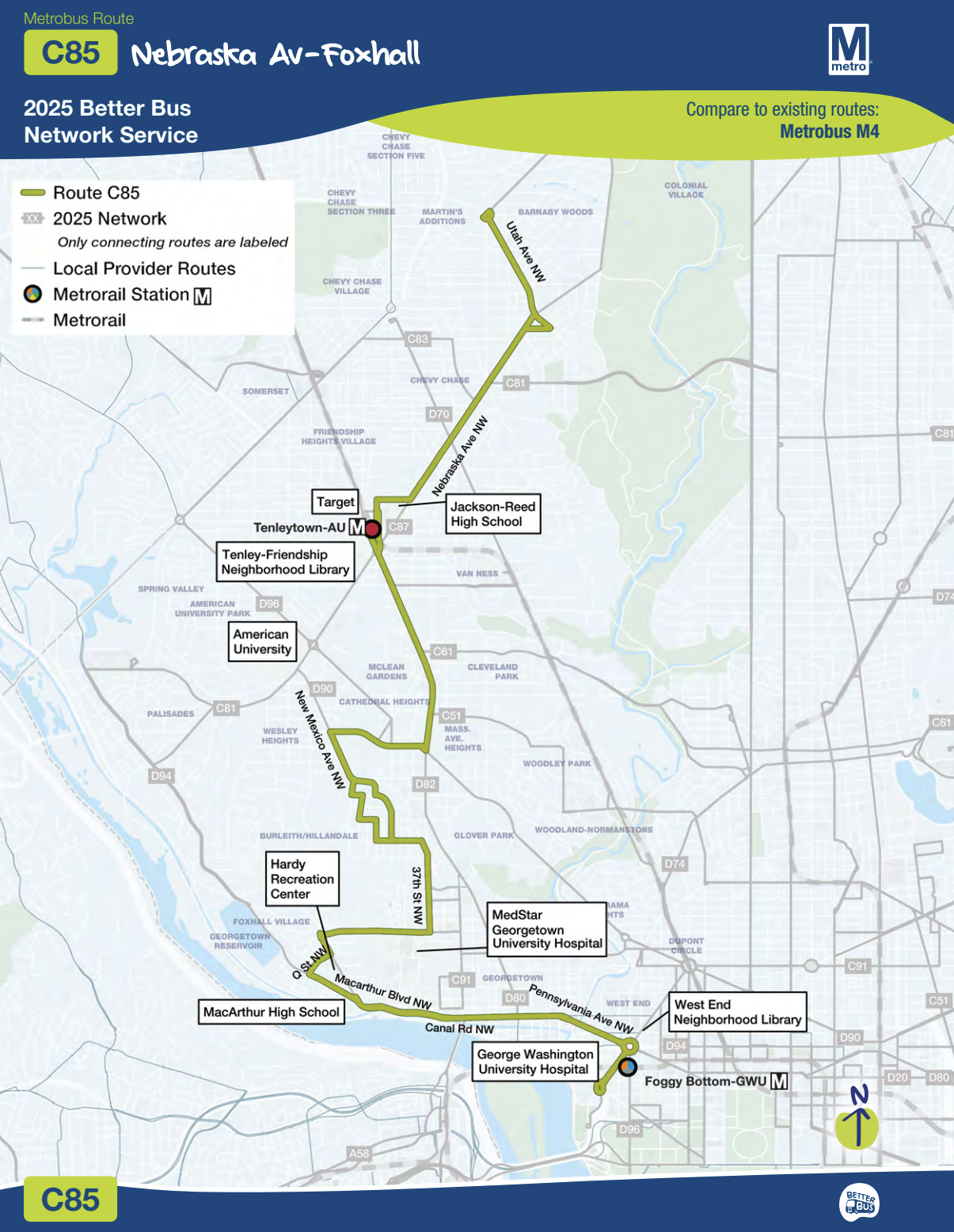
It travels from Foggy Bottom, through Georgetown on M St. to Canal Rd. Then after going through the eastern part of the Palisades, it turns back through Burleith and Glover Park upwards through Ward 3.
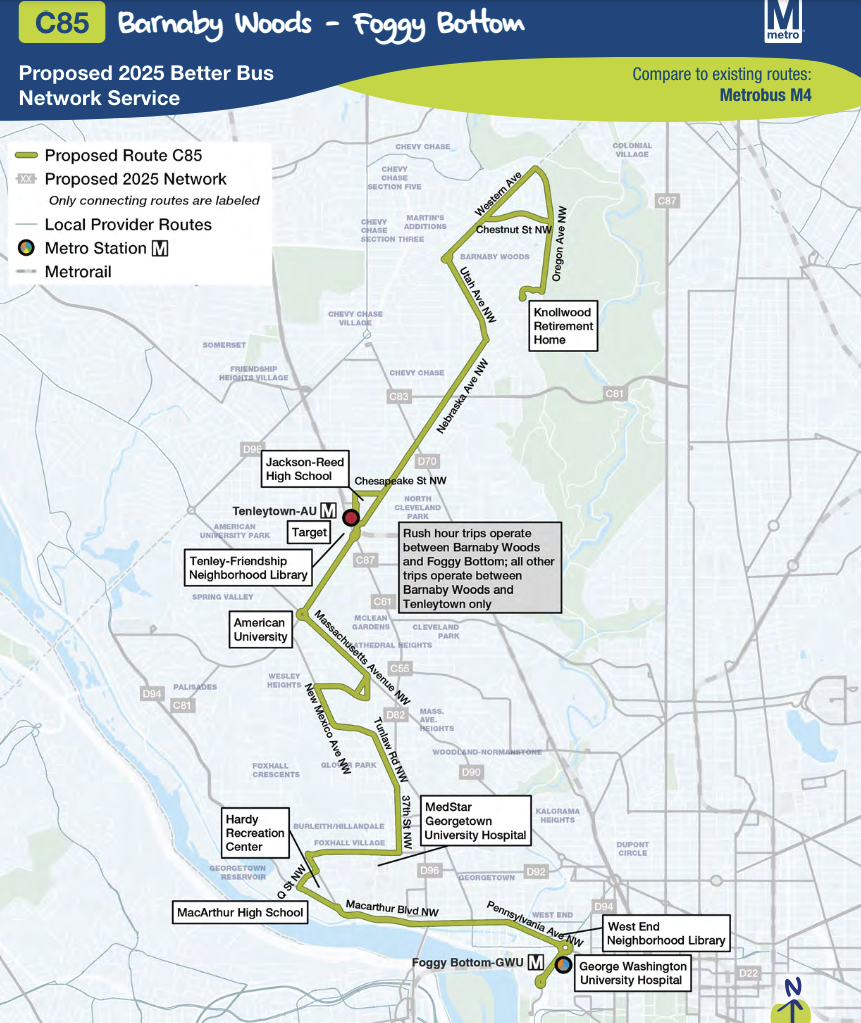
This route is mostly the same as earlier iterations, but they’ve modified the route substantially north of Burleith, as you can see from the earlier design:
In total, these tweaks are mostly that: tweaks. But the totality of the oncoming change is nonetheless monumental. Not since the (in my opinion) tragic demise of the streetcars and the “bustitution” that followed has such a radical change come to Washington’s surface transit.


Alas, this means no through buses to Union Station. It also means that downtown buses partly use the H St. corridor rather than the more convenient E St. corridor. And, as the GM previously has pointed out, it means less frequent service.
Maybe the goal is routes better adapted to current needs/use patterns. But I suspect much of this is driven by the need to cut back on bus service overall due to lower ridership (even after the COVID pandemic) and financial concerns.
Pingback: Northwest Georgetown February ANC Update | The Georgetown Metropolitan
Pingback: New Bus Network Rolls Out June 29th | The Georgetown Metropolitan
Pingback: Northwest Georgetown May ANC Update | The Georgetown Metropolitan
Pingback: Northwest Georgetown June ANC Update | The Georgetown Metropolitan
Pingback: Northwest Georgetown July ANC Update | The Georgetown Metropolitan