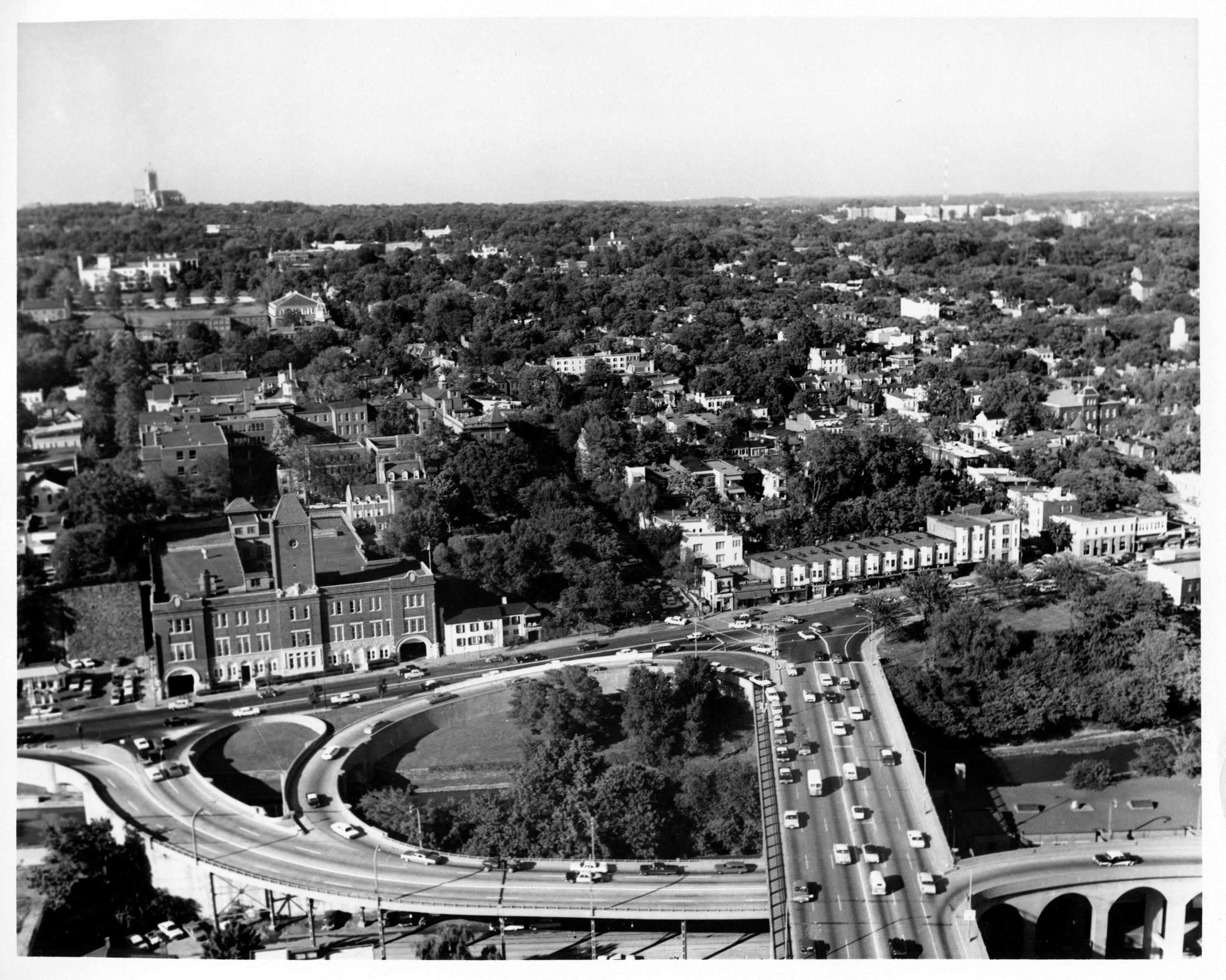
Today on Georgetown Time Machine, GM floats you above the Key Bridge looking north. There are actually few changes between then and now, but GM will try to point some out.
The first question is when is this from? The DDOT page from where this came doesn’t say. But it comes from a series that appears to be from the early 1960s. The arrangement of the ramps off the Whitehurst would be consistent with that.
One significant difference from today is the Car Barn. It is a building that has changed dramatically over the years. When it was first built it looked like this:

Notice how prominent the tower is. Plus it doesn’t have a clock on it. In 1911 the facade was bumped up and out a bit to look like this:

Notice how much flatter the facade became compared with the original. This is the state it was in for the aerial shot at the top. But this isn’t what it looks like today. Now another floor has been built set back a little from the facade. The tower, which once dominated the whole building, now just sort of peeks out.

So getting back to the original shot, what else has changed? Well one noticeable thing is the absence of the Cloisters development:

North of what is now the soccer field just has a few trees and then you can see Reservoir Rd. and Western High School behind it. The land was sold of by Georgetown Visitation in the 1990s and the homes were built on there.
The last thing GM notices is something he always notices with photos from this era is just how much more tree coverage the neighborhood had. Decades of failures by the city to keep the coverage as healthy as it was has left us where we are now. But hopefully with the efforts from organizations like Trees for Georgetown, we can get back to that scene once again.


You must be logged in to post a comment.