
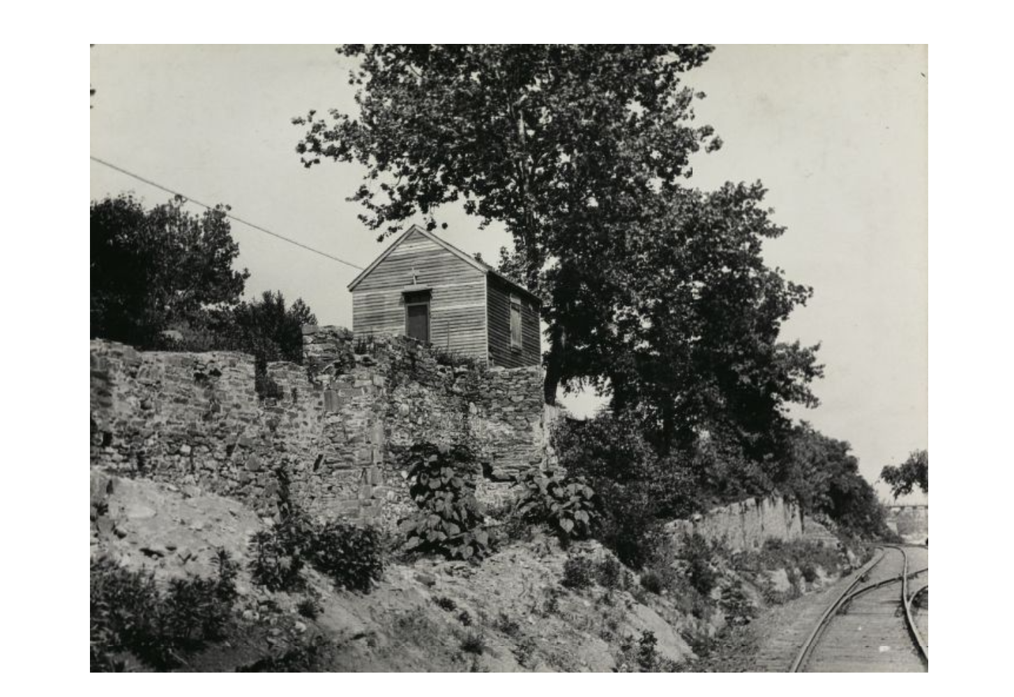
This week on Georgetown Time Machine, GM is exploring a photo of a tiny church that once stood along the canal just outside Georgetown.
The photo, from the DCPL archives, is undated. The only information was written on the back of the photo: “unidentified church on towpath above Georgetown. B.Thompson, purchase. Rec’d: May 1, 1945.” This date listed is likely the date that B. Thompson purchased the photo, and not the date of the photo. But GM will see what he can do to put a rough date and location for it.
First the location. That is a bit easier. In the bottom right corner, you can see the aqueduct bridge, as well the tracks of the B&O railroad Georgetown Branch spur. Based upon how close the bridge looks, as well as the leftward bend in the tracks, GM thinks this might be from about here (which is just east of the Canal Rd. and Foxhall Rd. intersection):
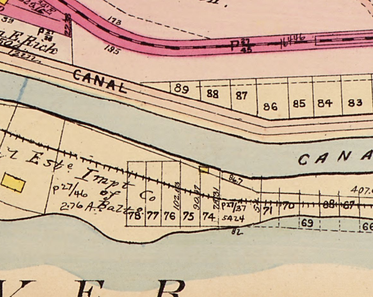
This map doesn’t indicate any track sidings as seen in the picture (that’s when train tracks temporarily spit into two tracks to let trains pass). But that level of detail might not be captured in this map, which is Baist’s Real Estate Survey map from 1911.
What the map does indicate is a small frame building between the tracks and the canal, which could be the church.
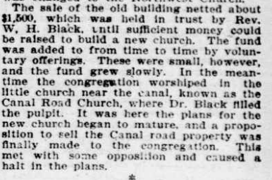
An article in the Washington Star from 1905 may be describing the church. It is primarily about the construction of a new Methodist church in the Palisades, but it describes the congregation temporarily using a church is calls the Canal Road Church:
GM could find no other reference to a Canal Road Church, or any other mention of a church that fits this description.
But now what about the when?
The tracks that brought trains into Georgetown were built between 1890 and 1910, with the Georgetown end being constructed towards the end of that period. So this photo is probably no older than circa 1910. And the Key Bridge was built between 1916 and 1923. If there’s any construction of the Key Bridge going on behind the Aqueduct Bridge in the photo above, it’s not much. So GM guesses this photo is from sometime in the 1910s.
The church is obviously long gone now. But there are still some stone foundations between the Capital Crescent Trail and the towpath at this spot which could be the same seen in the photo.


But, railroad tracks?
>
It’s obviously the building on the Baist’s map, but I think it’s too small to be even a little church. Looks more like a service shed. Recall that before Canal Road was widened in 40s? 50s?, there were quite a few buildings on the north side — used to be able to see some of the foundations. Plus, there was a squatters’ community at the top of the bluff, along the Glen Echo Line. It seems more likely that the church referred to would have been located there.