
I was working on another article idea that fell through, but was reminded of this old article from 2018. I thought I would repost it:
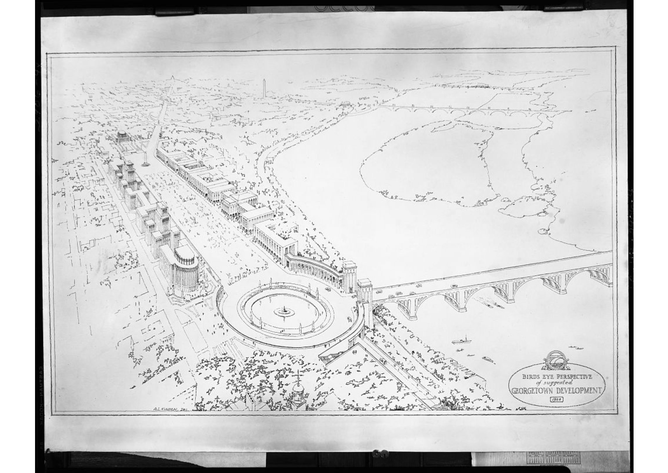
A little over two years ago, GM came across an image in the archives of the Library of Congress that was a bit alarming. It was a map of a proposed “Francis Scott Key Boulevard” which would run from the Key Bridge down M St. to Pennsylvania Ave. This is the image:

As you can see, this plan would call for a large traffic circle where Key Bridge meets M St. M St. would be replaced by a grand boulevard interspersed with three different medians. All of Georgetown from N St. south would, apparently, be destroyed.
There have been a variety of plans floated that would call for the construction of highways through downtown DC. Thankfully most of them were stopped. But none of those plans called for anything like this for Georgetown. (Most simply used the Whitehurst Freeway, which would have been attached to an expressway to the west that would cross the Potomac at a new Three Sisters Bridge and link up to the GW Parkway near Spout Run.)
So GM had no idea where this Francis Scott Key Boulevard came from or whether it was ever a real plan. Recently, however, Alex Block found references to the plan in an old book published by the Commission of Fine Arts. The book is Bridges and the City of Washington, published in 1974. Here is the page describing the plan:
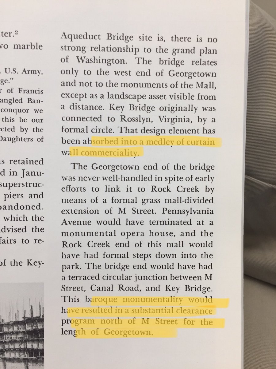
This is crazy. The author seems to be suggesting that the plans were part of the original plans for the bridge. Moreover they apparently called for the construction of a gigantic opera house at Pennsylvania and M?!
Here’s a version of the proposal from that book, which is quite similar to the map found by GM above:
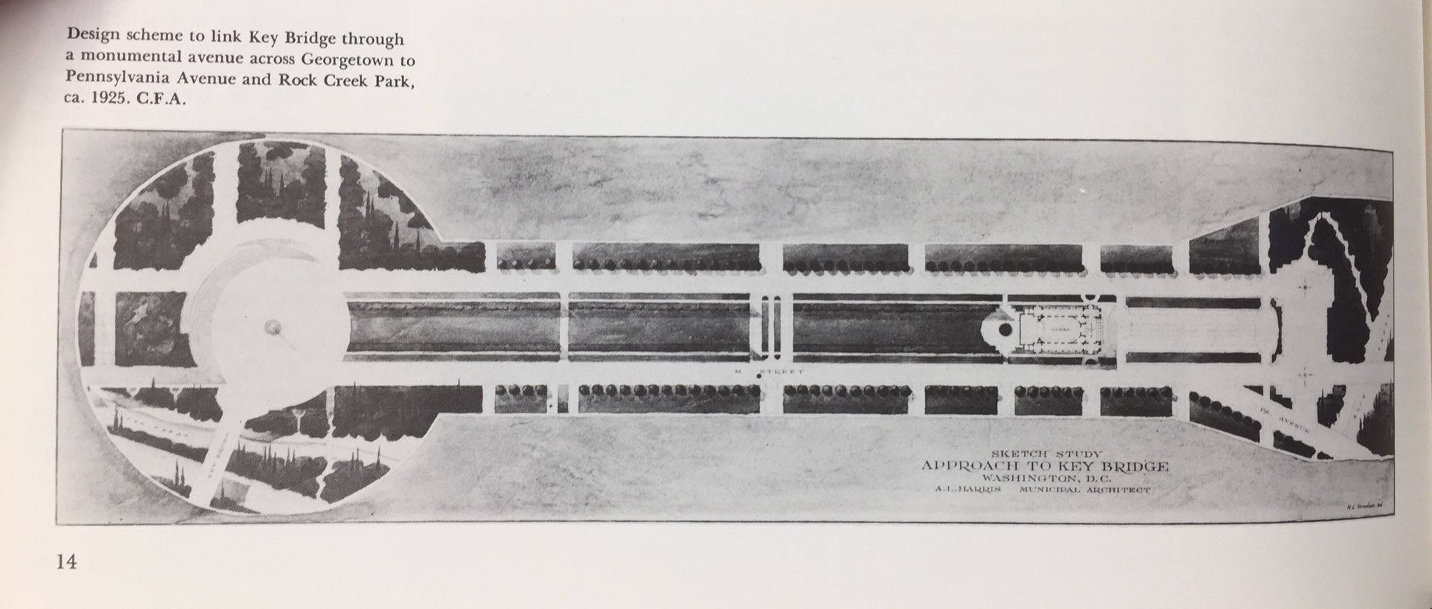
The caption for the drawing suggests that it was circa 1925. That’s just two years after Key Bridge was built, and several decades before any of the crazy highway plans emerged. If anything, this proposal was straight out of the City Beautiful movement that reshaped much of central DC in the early 20th century.
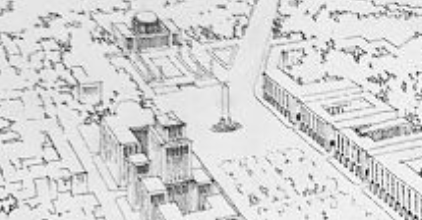
Look at how much of central Georgetown would be obliterated for this plan:
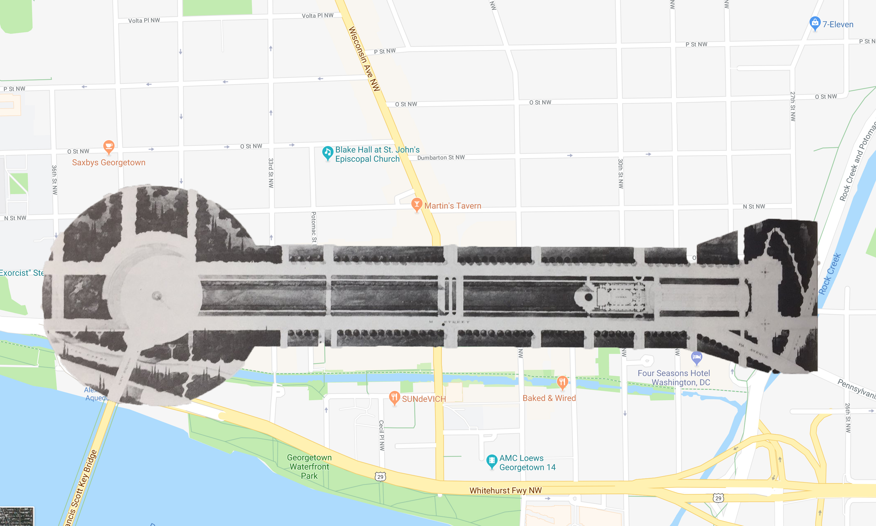
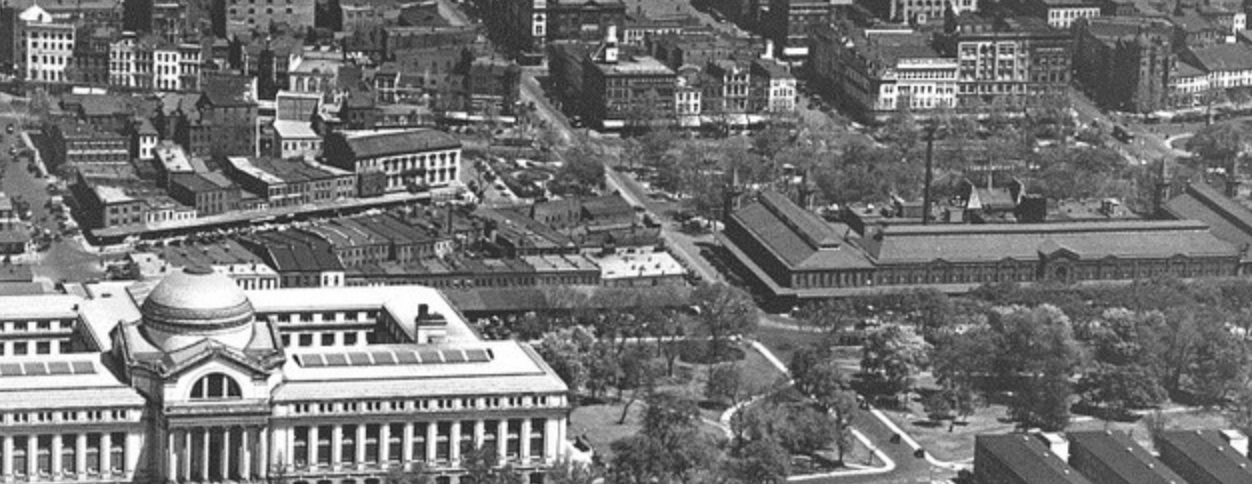
Maybe this would have produced a new beautiful mini-National Mall, but it definitely would have destroyed almost half of all commercial Georgetown. This would not have been a remote problem for the City Beautiful proponents. Just look at what Federal Triangle looked like before they got their hands on it:
It’s unclear whether this proposal ever got further than a few sketches, but it’s good it never came to pass. At least when the highway builders came to call, they had the sense to build the Whitehurst around Georgetown rather than barrel right through the heart of it.
A couple weeks later I received some additional information about just how crazy this plan was, and here is that second article:
Thanks to an astute reader, GM is now aware of some more of the insane plans that would have utterly demolished a huge swath of Georgetown had they been enacted.
The two additional renderings show more of what the new streetscape would look like. And it’s 100% straight from the City Beautiful playbook. It would call for a grand new boulevard lined with dramatic new civic buildings. Here’s some closer looks:

The landing of the Key Bridge would have a grandiosity that would make Albert Speer blush:
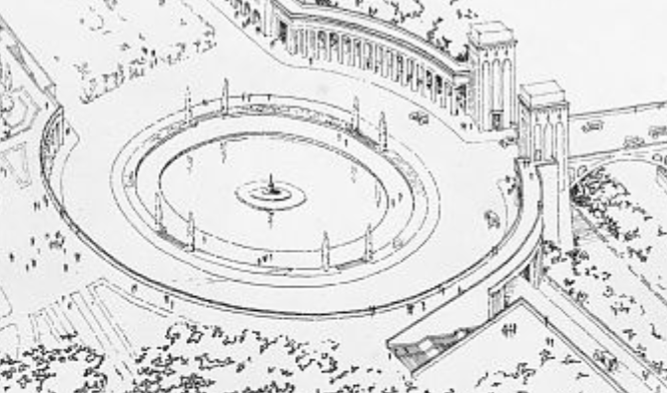
SERIOUSLY, LOOK AT WHAT THE ENTRANCEWAY TO THE KEY BRIDGE WOULD LOOK LIKE:
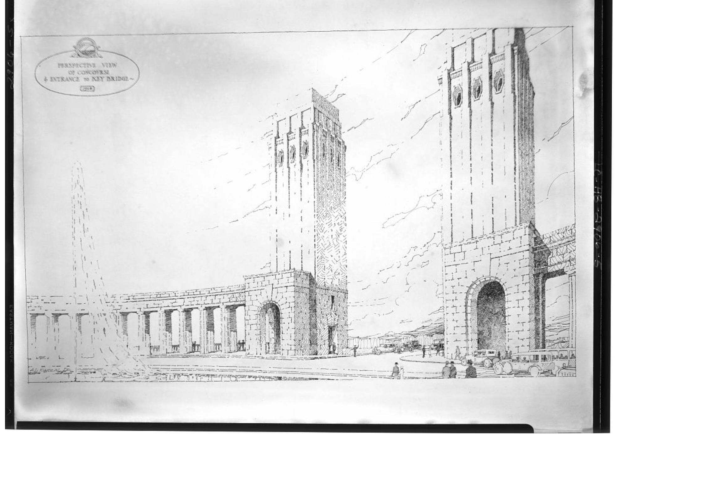
Besides being way over the top and dreadfully destructive of the existing neighborhood, the plans don’t make a lot of geological sense. Look at where Key Bridge enters that pantheon. It’s remains at grade all the way up to what was once N St. But that is not what the existing landscape looks like, at all. They’d have to excavate the cliffs around the Car Barn all the way past the old Georgetown Hospital. And ultimately the drop from N St. down to the circle would have been a lot steeper than the drawings suggest. They be at least as steep as the drop from the top of the Carn Barn to M St., and probably a bit more than that.
And despite that huge drop, the buildings on the north side of the boulevard appear to be built at grade with N St.:

That building looks to be at least eight to ten stories above N St. That would then put the drop from the top of the building down to the boulevard at around fourteen stories. That would be nuts.
Also, the proposed traffic circle would be huge. It looks like it would be about 550 feet in diameter. Keep in mind that circles like Dupont and Washington are more like 370 feet wide. The Key Bridge circle would be about as large as Lincoln Circle is around the Lincoln Memorial. (Which having been built just five years before these plans, may have been a large part of the inspiration.)
AND LOOK AT THOSE TOWERS:
Based upon the size of the humans in the rendering, the towers would be about 130 feet tall. Crazy.
Anyway, the plans obviously never got built. And despite GM’s diligent search through the Post archives, he can’t find any hint that these plans ever entered the public dialog. Maybe they were just the ravings of a City Beautifuler after too much Viennese coffee?


The designer clearly loved the Torres Venecianes in Barcelona; a very similar pair of pointless towers.
How curious that there is no connection to a planning agency, public or private. An architect’s flight of fancy? As you say, it looks more like an Albert Speer fascist dream, rather than a Beaux Arts plan, which would have been more humane. As to the bridge pylons, take a look at the State Street Viaduct next time you’re in Harrisburg! More … the engineering challenges would have been huge: the escarpment between Prospect and M Streets is native rock in many places. The blasting alone would have leveled the old buildings destined for demolition. Finally, a close look at the enlarged ninth image shows a car about to enter a covered entry, suggesting a lower level below the grand boulevard.