

Potomac River
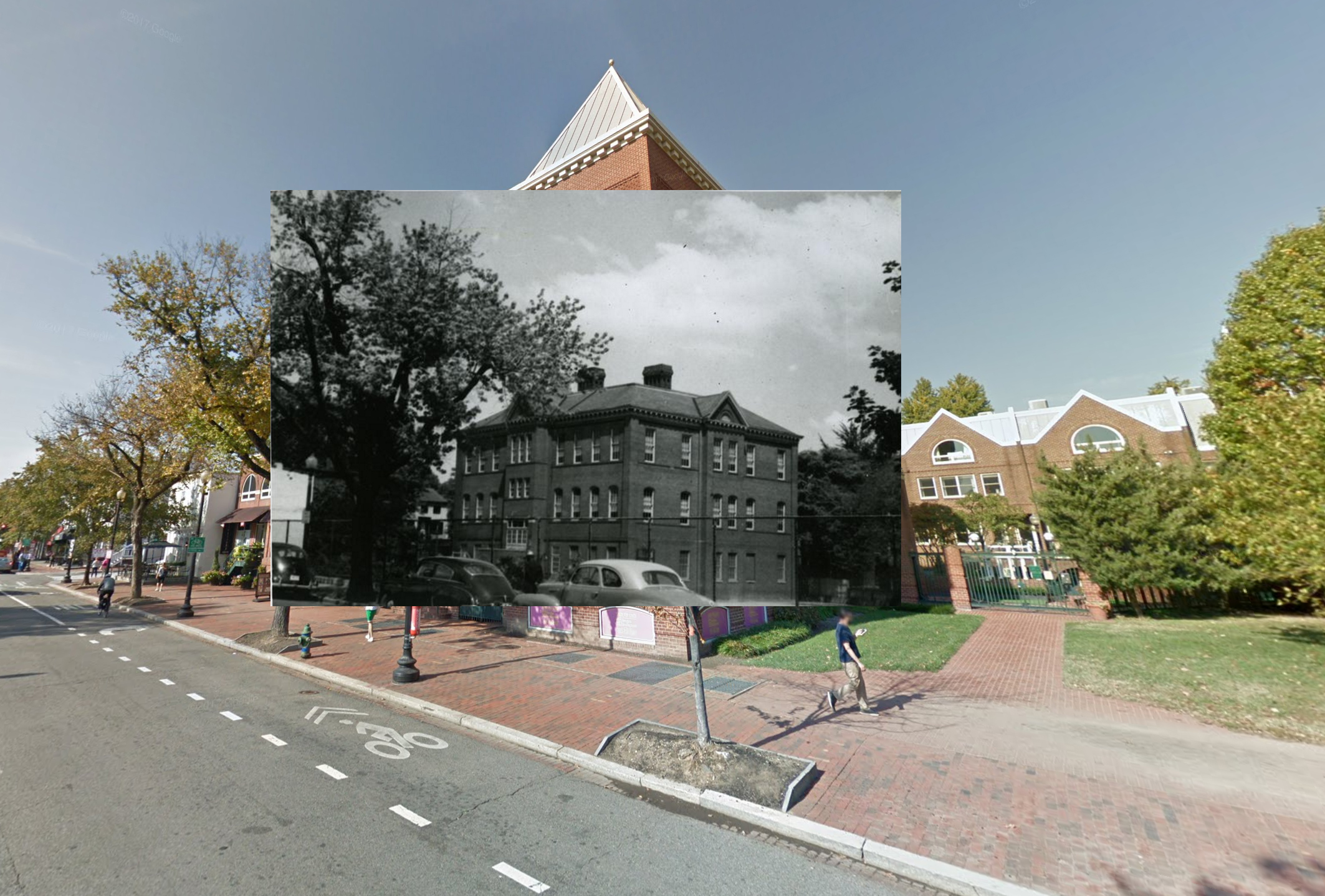
This week for Now and a Long Time Ago, GM is back with another photo from the Wymer Maps. This one is of the Corcoran School on 28th but from M St. (Don’t get it confused with the Fillmore School on 35th, which was until a few years ago owned by the Corcoran Art School and was covered with large “Corcoran” signs. The school on 28th is actually named after Thomas Corcoran, a former mayor of Georgetown. It was his son, William Corcoran, who founded the Corcoran Art Gallery, which ran the art school until it sold it to Georgetown Washington University.)
It’s a view you can’t get anymore since the construction of the office building complex on the former playground/parking lot of the school. GM is not sure when that complex got built since it’s not in the master building database he uses, but it sure looks like it was built in the 1980s. Continue reading
Filed under Uncategorized
 Photo by Mike Maguire.
Good morning Georgetown, here’s the latest:
Filed under Uncategorized
 Photo by Marc Andre.
Good morning Georgetown, here’s the latest:
Filed under Uncategorized

The Father’s Day concert in the park will take place, um, Father’s Day, which is this Sunday, if you’ve forgotten. It will be at Volta Park and the Walkaways, who performed last year and are fantastic, will perform again.
See you there!
Filed under Uncategorized
 Photo by albedo20.
Good morning Georgetown, here’s the latest:
Filed under Uncategorized
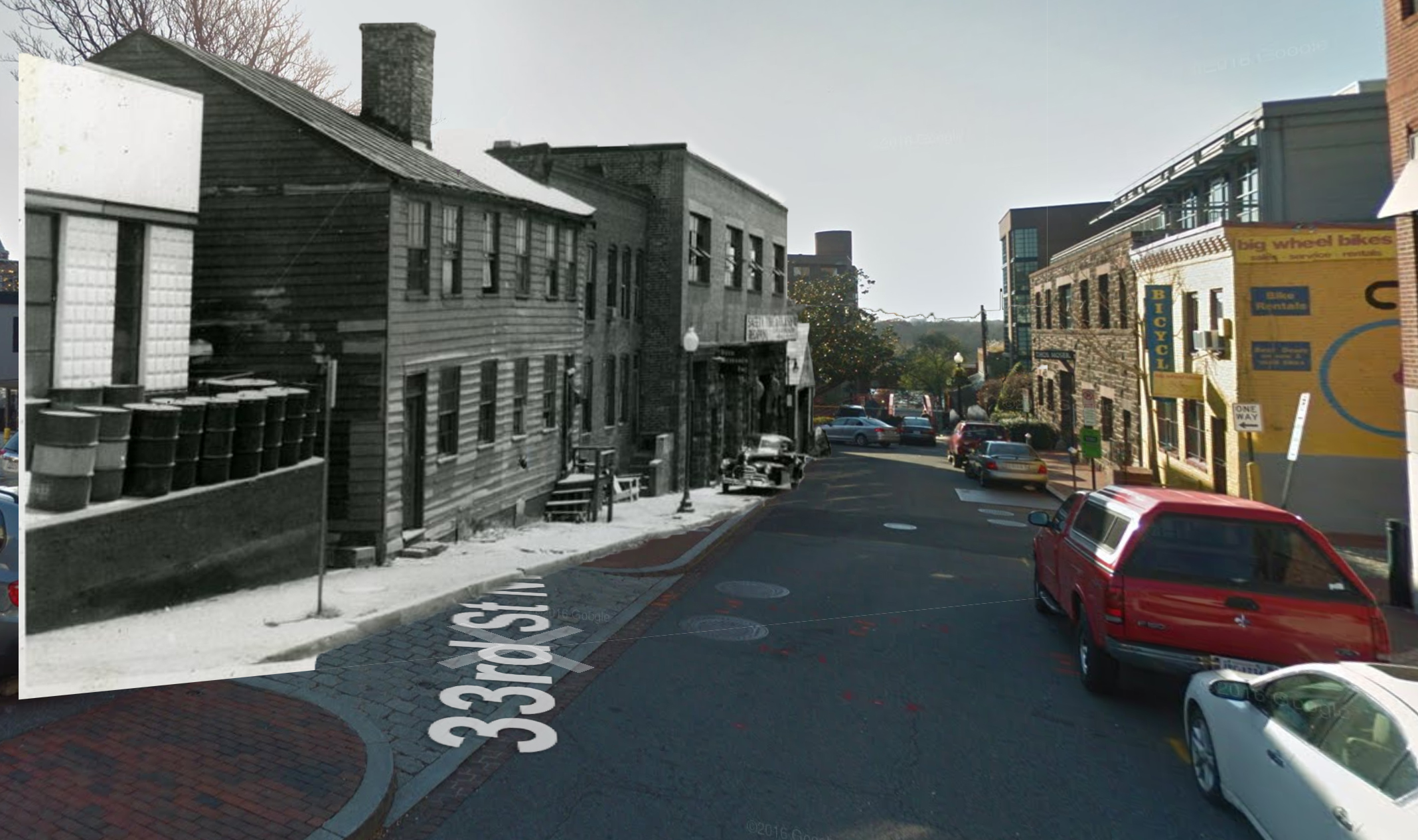
This week for Now and a Long Time Ago, GM returns with another photo from the great Wymer archive at the DC Historical Society. Today, it’s of the 1000 block of 33rd St., just below M St.
On the left you can see a row of buildings, half of which appear to still remain. The wood frame buildings are gone. Here’s what the row looked like as a map in 1919, about 20 years before the photo was taken:
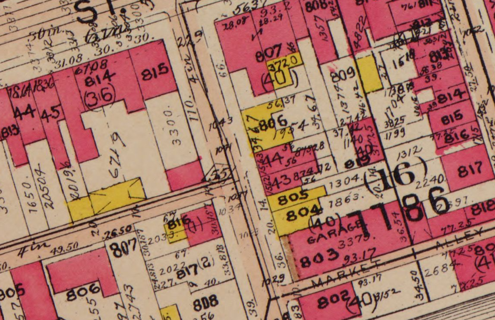
Yellow buildings on this map are wood frame buildings. So the yellow buildings under the 806 are the wood frame buildings in the photo. Given the lack of signs, they appear to be homes. The next two buildings in the picture appear to correlate to the pink buildings in the map (pink means brick or stone).
The next building in the photo appears to be the same building that exists there today. But it doesn’t seem to be consistent with the map, which suggests two more narrow wood frame buildings and then a brick or stone garage. And that makes sense since the building that’s there now was built in 1932.
The last gable front brick building at the bottom of the street also appears to be the same as the one that is there now. It was apparently built in 1906. Continue reading
Filed under Uncategorized


You must be logged in to post a comment.