
Last week, the owners of the popular bagel shop, Call Your Mother, appeared before the Board of Zoning Adjustment to request a variance to operate their shop at 3428 O St. NW, on the corner of O St. and 35th. While the ANC voted to approve the variance, and the Office of Planning also supported it, a group of neighbors, living adjacent or nearby, as well as the ANC commissioner for the location objected to the variance. While the BZA deferred a final decision on the application to December, it’s worth taking a moment to consider how absolutely absurd it is that zoning makes such approval necessary in the first place.
Zoning regulates the size and use of properties. Each property is assigned a particular zone, which sets forth, among other things, how tall the building can be, how much of the property area it can cover, and (most important for this discussion) what you can do on the property. For most residential zones, the only thing you’re allowed to do “by right” (i.e. without having to seek additional approval) is to use it as a home. Commercially zoned properties, on the other hand, allow you to do just about any (legal) commercial enterprise on site.
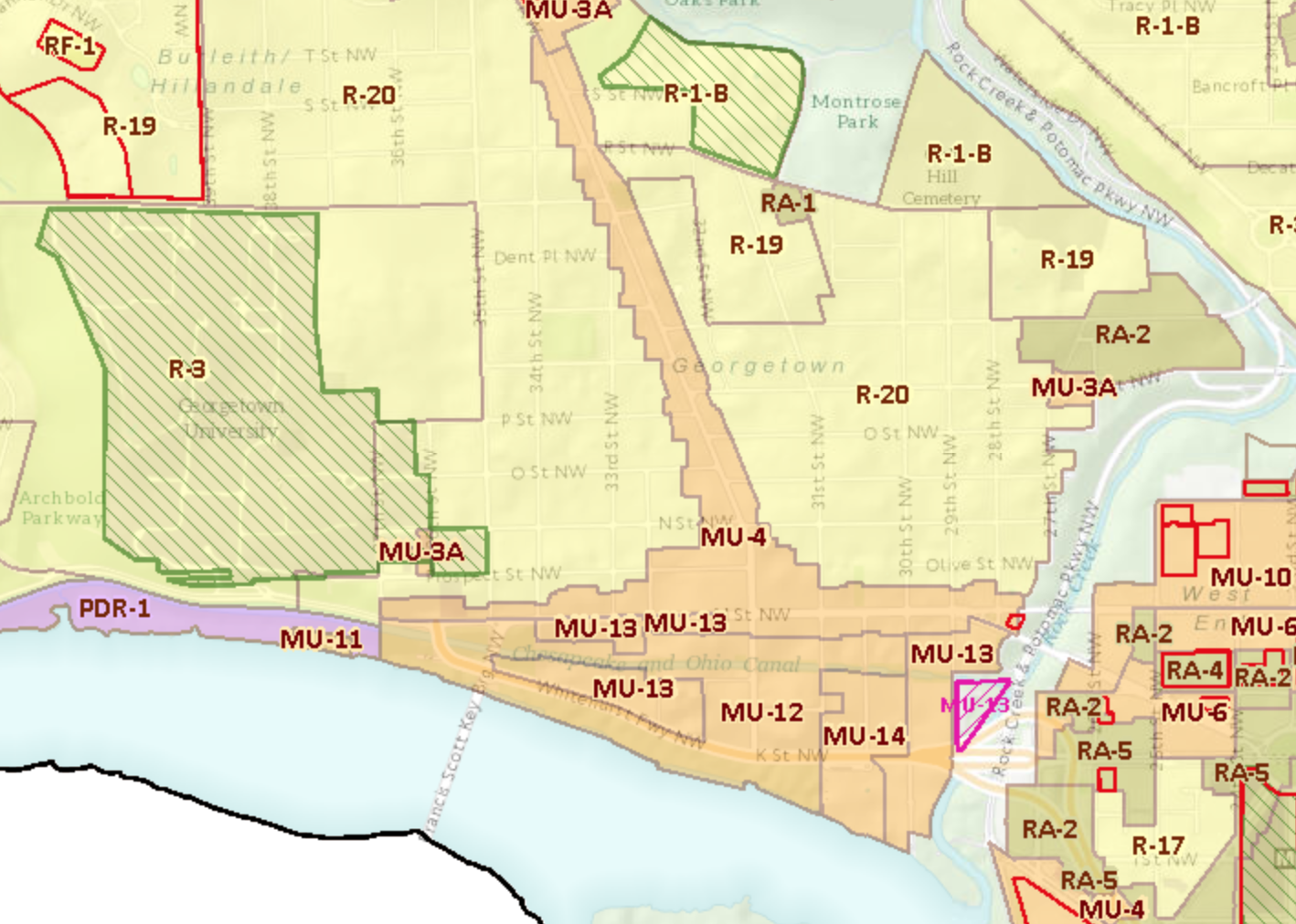
Georgetown is a mix of residential and commercially zoned blocks:

Roughly speaking, the yellow areas are the residentially zoned blocks. For Georgetown that includes R-19 (for blocks with primarily detached homes) and R-20 (blocks primarily full of rowhouses). There are a few more varieties of commercially zones. MU-4 covers most of Wisconsin Ave. and M St. MU-12, 13, and 14 covers south of M St. (this area used to be zoned as “Waterfront”, but that name was changed with the zoning rewrite several years ago).
This map, of course, wasn’t around when Georgetown was being built into what it is today. The first significant zoning laws were adopted in DC in 1920. The laws were largely modeled after New York’s. From the beginning, though, they did pretty much the same thing the modern zoning laws do: regulate the size of buildings and how they can be used.
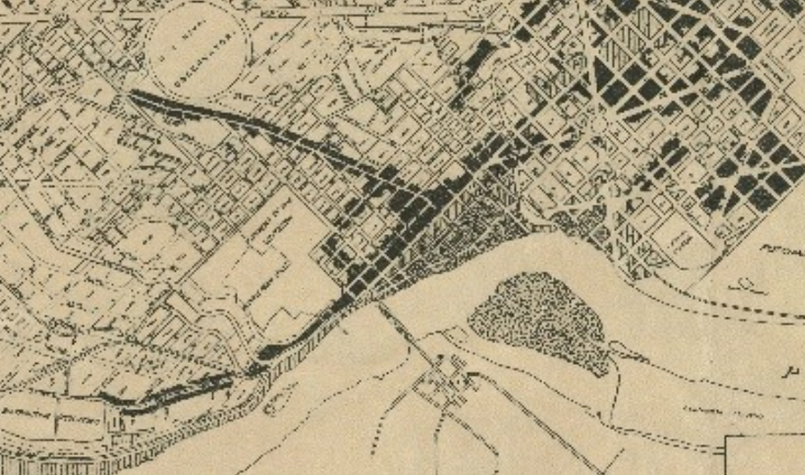
A map was drawn up in 1921 delineating for the first time what blocks would be commercial and what would be residential. Here is the Georgetown portion of the 1921 use map:

The black colored blocks are the commercial blocks, the light colored blocks the residential. As you can see, obviously M and Wisconsin were zoned for commercial from the start. But this map allowed for a substantial amount of commercial into the residential neighborhood. P St. west of Wisconsin was almost entirely zoned for commercial. 36th St. was as well. And a portion of P St. in east Georgetown (the heart of the historic black Herring Hill neighborhood) was also zoned commercial. Continue reading →


You must be logged in to post a comment.