
This week on Seven Georgetowns, GM is going to discuss the northern tip of Georgetown, which he uncreatively has dubbed: Upper Georgetown.
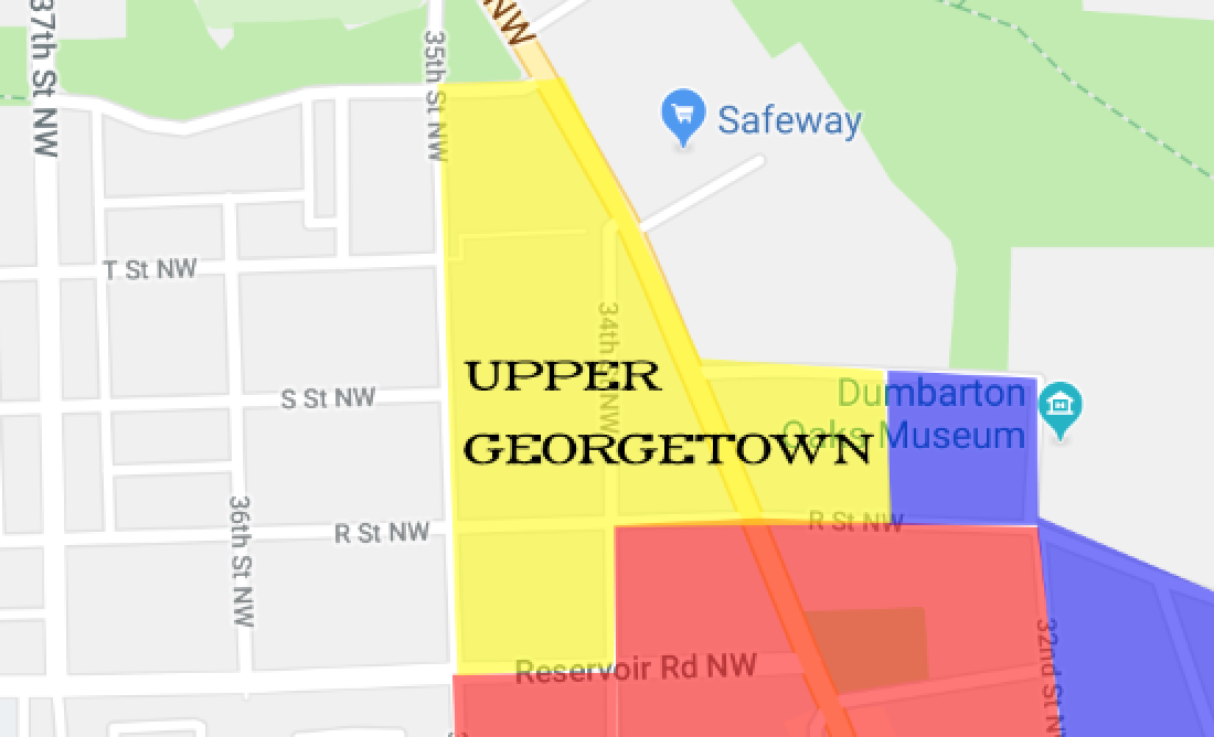
It probably makes sense to first describe the official northern boundaries of Georgetown itself, to help explain Upper Georgetown’s boundary. Georgetown is the only neighborhood in DC that is actually defined by federal law. (The definition is necessary to describe where exactly the Old Georgetown Act applies). The northern boundary of Georgetown, according to that definition, runs east along Reservoir Rd. from just west of the hospital. Then it heads north down the center of 35th St. to Whitehaven Parkway. From there it runs east of Wisconsin and meanders through the woods until it hits Rock Creek.
Upper Georgetown’s southern border is Book Hill, which comes to a natural northern end at the library. The eastern border is a bit fuzzier. GM figures that at some point between 32nd and Wisconsin, R St. and S St. stop being Georgetown Heights and start being Upper Georgetown, but it’s not a bright line. Continue reading →


You must be logged in to post a comment.