
Last week, GM took a deep dive into a random real estate new article from 1902. In charting out the physical reality described in the article, he relied on a couple very old, very detailed maps. GM thought it would be interesting for readers to learn exactly where those came from and how they might check them out for themselves. It can even help you find the first “picture” of your house.
The maps are insurance maps. They were drawn up to give fire insurance companies an accurate picture of what risk any particular building might face. As a result they depict each structure’s footprint in enormous detail, including the building’s materials (i.e. wood versus brick). Plus, they’re just really lovely maps.
Several different companies prepared the maps for DC, including most notably G. M Hopkins and the Sanborn Map Company. Digital versions of some of the annual collections of maps are available online.
For the earliest collection GM can find, go to the DC Public Library’s online Washingtonia Collection. They have five different editions of the G.M. Hopkins maps, with the earliest from 1887.
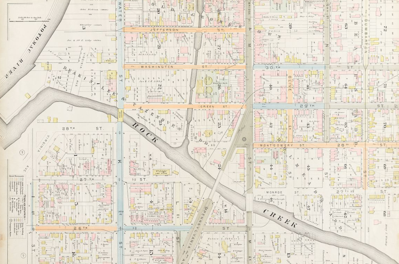
The way they typically work is that the first page has a key to to whole city showing with plate each part of the city will appear:

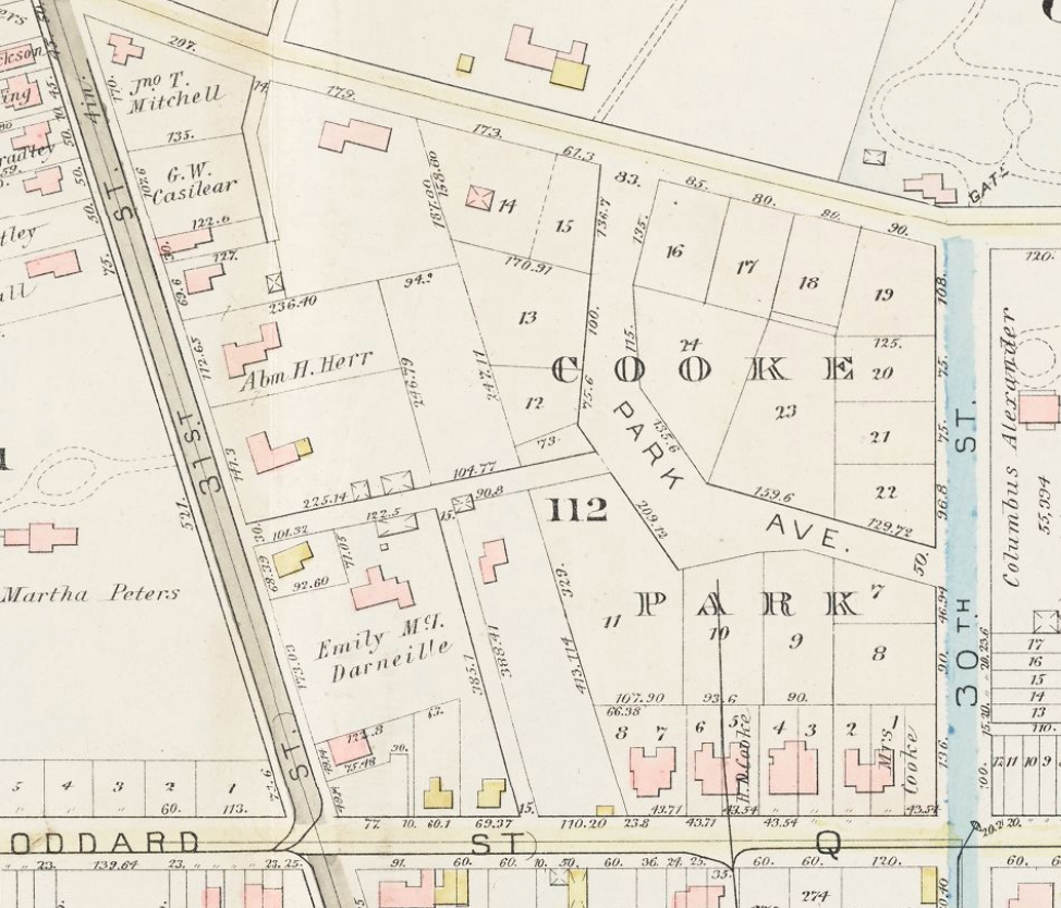
You then can navigate to that plate to see the detailed map. For instance for the 1887 map (above) lower east Georgetown appeared on Plate 38:

(As with this plate, often they appear with north facing right, instead of up.)
The Hopkins maps are interesting both because they are the oldest and because they have a great deal of information about the property owners:
 Continue reading →

 Photo by Joe Flood.


You must be logged in to post a comment.